
The U.S. and many of China’s neighbors accuse Beijing of using “gray zone” tactics that are not legally acts of war to intimidate other countries and assert greater control over the area. In response, the U.S. regularly conducts “freedom of navigation” and other operations in international waters and airspace.
China says it is protecting its sovereignty and maritime interests and that “close-in reconnaissance” by American planes and warships threatens its national security and undermines regional peace and stability.
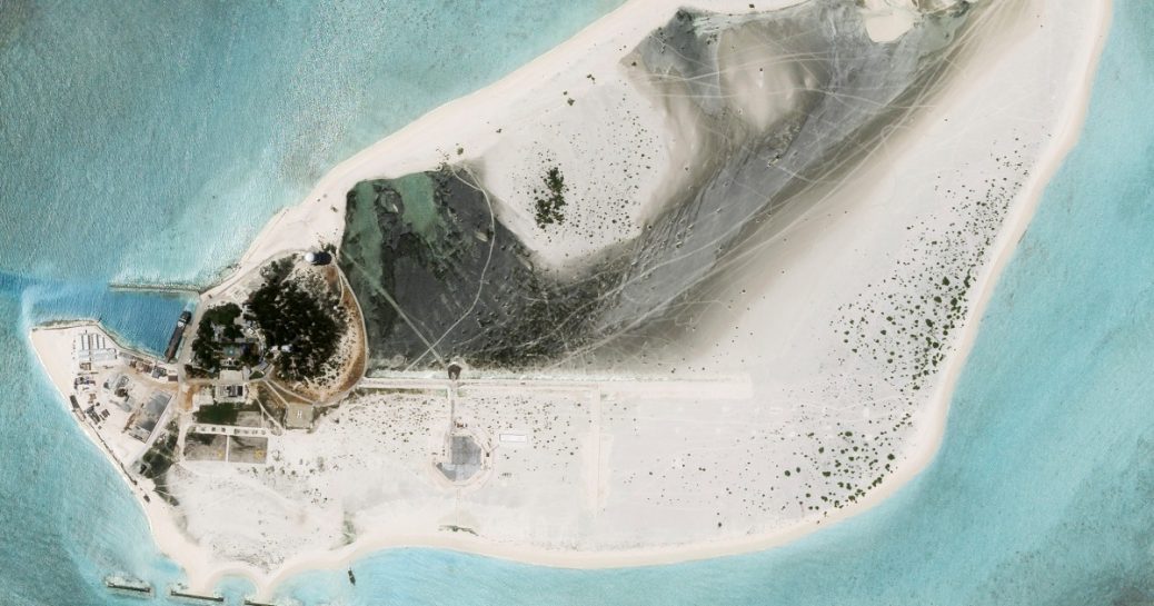
Triton Island, which China has controlled since 1974, is the westernmost and southernmost point of the Paracels, almost the same distance from the Vietnamese coast and China’s island province of Hainan.
Powell said the construction there “will clearly make Vietnam agitated.”
“It is the closest of the Paracel Islands to the coastline of Vietnam,” he said. “It is China building on an island Vietnam claims — they will see it as one more threat to Vietnam’s security.”
The satellite images show vehicle tracks across almost all areas of the island, as well as what appear to be containers and construction equipment. They also show a small harbor, a helipad and buildings that were already there.
The latest image also clearly features a star from China’s flag and a hammer and sickle, a symbol of China’s ruling Communist Party, on two fields with a slogan on the ground nearby that reads “The Party shines brightly! Long live the motherland!”
China has not provided any information about construction on the island.


Recent Comments