I’ve put together a list of 15 of the best hikes in Durham, North Carolina. I recently spent a lot of time in the region, and being a big fan of the outdoors, I got to know some of the best trekking that Durham and the surrounding areas have to offer.
Nestled in the heart of North Carolina’s Piedmont region, Durham offers a blend of urban sophistication and natural beauty, making it an ideal gateway for hiking adventures. Time spent in and around Durham hiking is a great way to enjoy the region’s stunning countryside.
From the rolling hills and peaceful lakeshores to the nearby Appalachian foothills, Durham has an assortment of trails suitable for all skill levels. Whether you’re looking for a leisurely stroll or a more challenging climb, Durham’s hiking trails won’t disappoint.
Best Hikes in Durham, NC
I love the outdoors and have hiked in countries all around the world. From the stunning vineyards of Florence to the lush forests of Catalunya and the beautiful mountains of southern California, I love it all, but I found the hiking trails in Durham to be some of my all-time favorites.
For me, it doesn’t always need to be a mega climb to the top of a mountain, so I’ve compiled my list based on a number of factors. I’ve considered aspects such as natural beauty, the quality of the trails, things to see and do on the way, levels of difficulty, and even how easy it is to park. I’m sure you’ll discover several new excellent Durham trails to suit you.
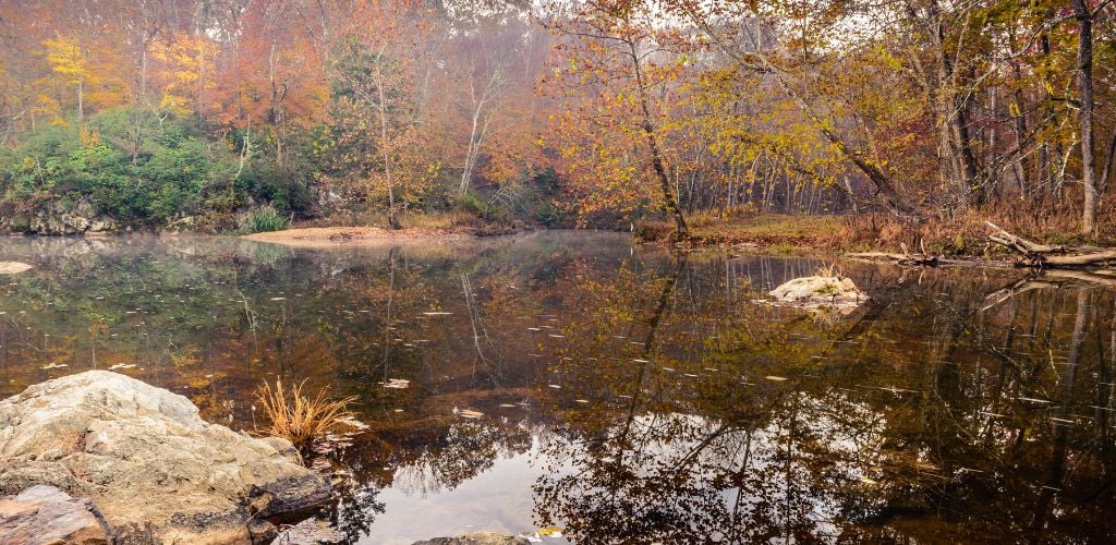
1. Cox Mountain Trail at Eno State Park
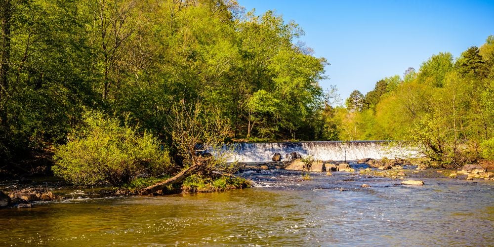
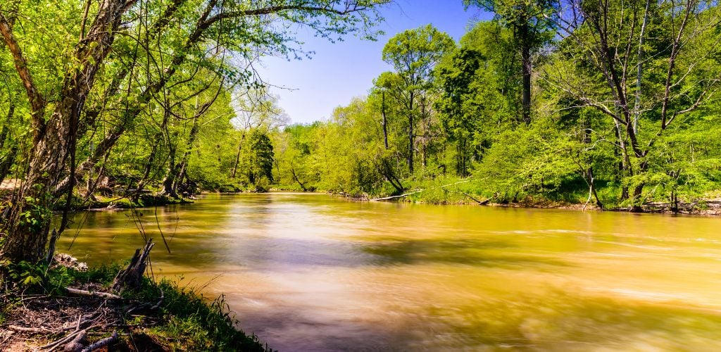
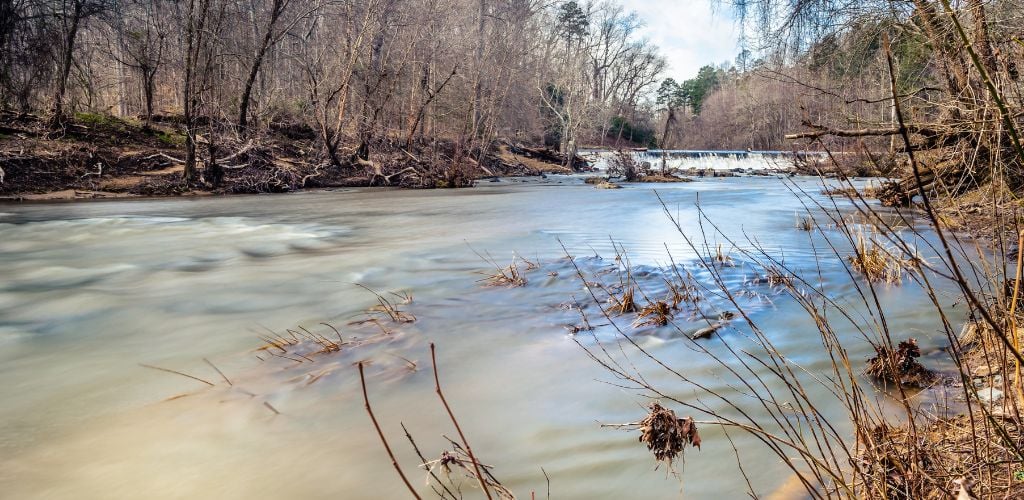
One of the most popular places to visit in Durham is Eno State Park, which will appear a few times in this list. It offers several scenic trails with varying levels of difficulty and length and some of the most stunning scenery. The Cox Mountain Trail is a good place to kick things off. A moderate to hard 4-mile roundtrip that showcases the beauty of the Eno River.
My husband and I walked through a mix of dense green woodland areas, as well as some rocky terrain, and were rewarded with stunning views of the Eno River. The elevation can be a challenge in places, so is perhaps better suited to those seeking more of a workout than a walk. But the well-maintained trails mean it’s by no means out of reach for moderate hikers.
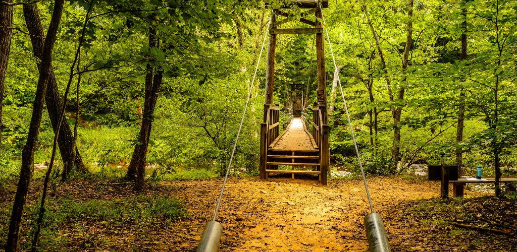
The Cox Mountain Trail is one of my favorite places to hike in Durham because of the Eno River suspension bridge that features along the way. The 124-foot wooden bridge is not for the faint-hearted as it moves a little with every step as you cross the river. But of course, it’s safe and secure and is an amazing addition to an already great hike.
Trail Details and Information
Location: 6095 State Rd 1569, Durham, NC 27705, United States. Click here for directions to the trailhead.
Length: 4 miles / 6.6 km
Duration: 2-2.5 hours
Type of Trail: Circular
Elevation Gain: 123 meters
2. Occoneechee Mountain Loop Trail

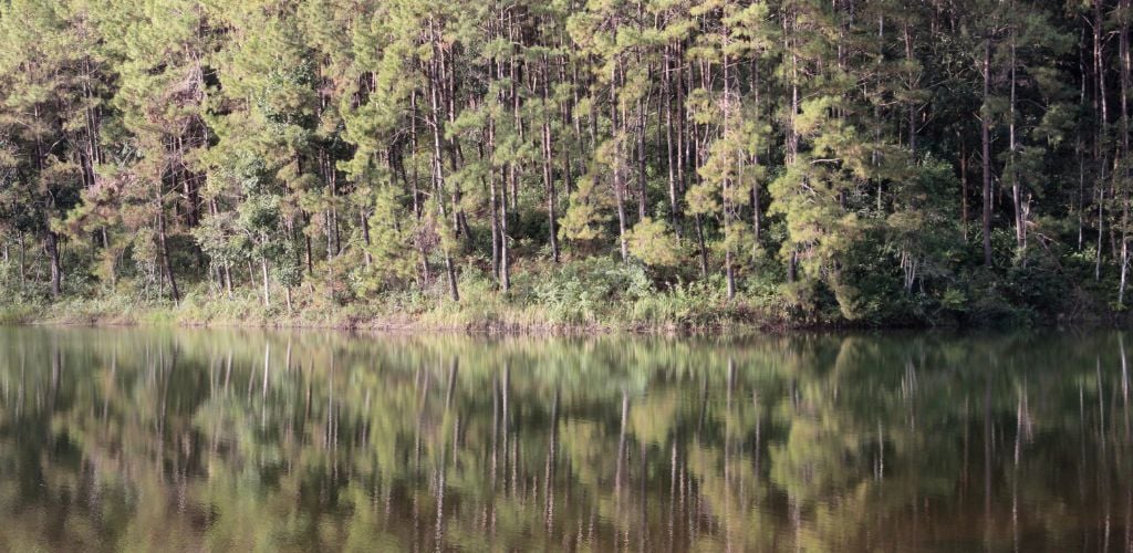
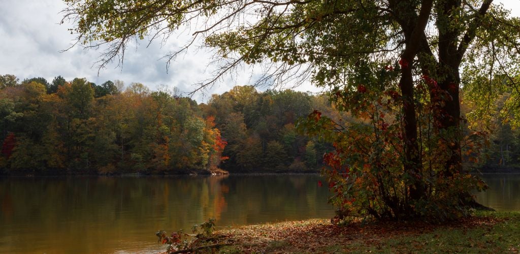
Many hiking trails near Durham are just a short drive away. The Occoneechee Mountain State Natural Area offers some fantastic trails and is just 20 minutes away in neighboring Hillsborough. The mountain itself is said to be the highest peak between Hillsborough and the coastline to the east, standing at 350 feet above the Eno River.
The longest, and my preferred hike here, is the Mountain Loop Trail, which at 2.2 miles and a relatively flat terrain is an easy to medium hike that I’ve seen all ages and abilities taking on. Just be wary of occasional big tree roots that can affect the paths. My advice is to head off counterclockwise as this will get you closer to the overlook.
As the name suggests, this loop trail starts and finishes at the same place -the parking lot, where you’ll find plenty of free-to-park spaces. This is a particularly beautiful hike during the fall when the leaves begin to change but is equally enjoyable any time of year.
Trail Details and Information
Location: 625 Virginia Cates Rd, Hillsborough, NC 27278, United States. Click here for directions to the trailhead.
Length: 2.2 miles / 3.54 km
Duration: 1.5-2 hours
Type of Trail: Circular
Elevation Gain: 100 meters
3. Trinity Park to Duke Gardens
For me, one of the best treks in Durham is the hike from Trinity Park to Duke Gardens. This is more of an urban hike of my own creation but I think it merits a place on this list.
The route starts and finishes in Trinity Park but incorporates a cut directly through the center of the Duke East Campus, turning left at 9th Street, before veering off towards Duke Gardens.
Once you arrive at Duke Gardens, you’ll need to factor in how much energy you have in your legs, as you can easily rack up a good few miles walking around here. So, despite being a very flat, well-maintained walk, I would class this hike as being of medium difficulty due to the distances involved in a there and back trip.
Trail Details and Information
Location: 410 Watts St, Durham, NC 27701, United States. Click here for directions to the starting point.
Length: 4.2 miles / 6.8 km + 1 lap of Duke Gardens is approx. 1 mile / 1.61 km
Duration: 3.5-4.5 hours
Type of Trail: Out and Back
Elevation Gain: Predominantly flat
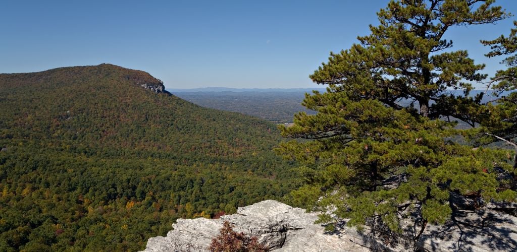
4. Hanging Rock Trail
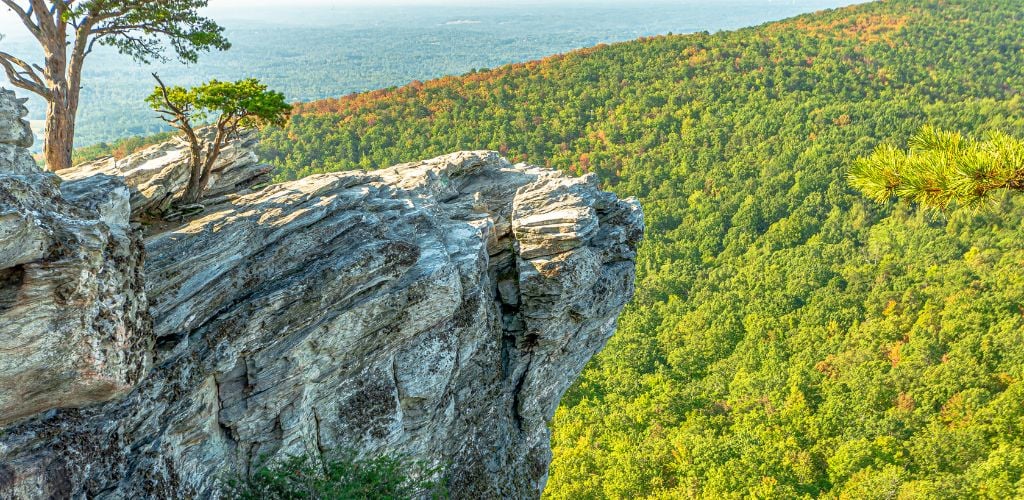
Heading a little further out of town, one of the best hikes near Durham is the Hanging Rock Trail. You’ll need a car to get to this one as it’s a couple of hours away from Durham, but it’s absolutely worth the trip. The large quartzite rock formation that you’ll find at the end gives the trail its name. There are also stunning panoramic views of the Piedmont region from here.
It’s a relatively short walk at 1.3 miles (2.6 miles out and back) but it has some steep elevation gains that shouldn’t be taken lightly. It’s a popular walking route so can get quite busy at weekends and on holidays but there’s ample parking at the visitor’s center where the trail begins.
Another bonus of the Hanging Rock Trail is the warmer temperatures during the colder seasons. Due to its geographical location, you can hike year-round. It’s one of the best winter hikes in Durham and the surrounding areas.
Trail Details and Information
Location: 1790 Hanging Rock Park Rd, Danbury, NC 27016, United States. Click here for directions to the trailhead.
Length: 2.6 miles / 4.2 km
Duration: 2-3 hours
Type of Trail: Out and Back
Elevation Gain: 182 meters
5. Hemlock Bluffs

Just to the south of Durham is Hemlock Bluffs, a unique and ecologically significant area due to the rare Hemlock trees that grow there. The steep bluffs are north-facing, which protects the trees from higher temperatures allowing them to grow in a region where they should no longer be. Around 250 remain, though fossils show historically they once thrived in this area.
It’s a popular spot for bird watching, relaxing, or taking gentle walks, and Hemlock Bluffs offers several short trails and hikes near Durham. You could make a lengthier hike by combining some of these easy-to-moderate loop trails.
The longest of the routes is the Chestnut Oak Loop Trail at 1.2 miles, which cuts through woods, along streams, and past the huge Hemlock trees. There are a number of other shorter trails too, all of which begin at the Stevens Nature Center, which provides a great deal of information on the local area and wildlife.
Trail Details and Information
Location: 2616 Kildaire Farm Rd, Cary, NC 27518, United States. Click here for directions to the trailhead.
Length: Chestnut Oak Loop Trail – 1.2 miles / 1.9km
Duration: 25-35 minutes
Type of Trail: Circular
Elevation Gain: 28 meters
6. Holden’s Mill at Eno State Park
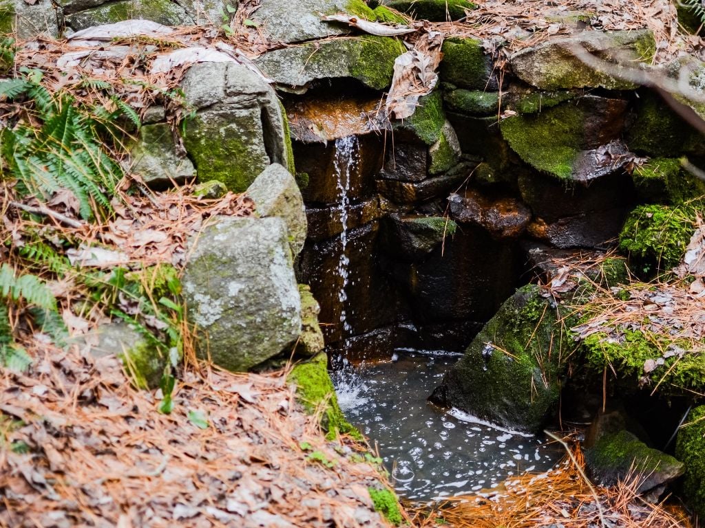
Back to Eno State Park for one of my favorite walking trails in Durham. Taking in some historic buildings, as well as the water rapids of the Eno River, the Holden’s Mill Trail is a 3.9-mile moderate hike. During the warmer months, there are also good accessible spots for swimming and other water-sport activities along the route.
Holden Mill played a part in the history of the region and was founded as a corn, flour, and sawmill in 1811. It would have been a central point for grain production and a spot for community growth and development. The ruins of the old water-powered mill, as well as a few smaller barns, add a nice historic and educational element to this hike which I really enjoy.
As with most trails at Eno State Park, there’s ample parking available and clean toilet facilities at the visitor’s center. The trails are well-maintained and dog-friendly making it a great option for hikes in Durham with a four-legged friend.
Trail Details and Information
Location: Eno State Park, Durham, NC 27705, United States. Click here for directions to the trailhead.
Length: 3.9 miles / 6.3 km
Duration: 1.5-2.5 hours
Type of Trail: Circular
Elevation Gain: 112 meters
7. Weymouth Woods

If you’re looking for some easy hikes around Durham, then head to Weymouth Woods. Just 25 minutes to the south is the 900-acre nature reserve dominated by the Long Leaf Pines for which central North Carolina is famous. Weymouth Woods features a network of predominantly flat trails that allow visitors to explore the pine forests.
The Lighter Stump, Pine Barren, and Holly Road Loop trail is a popular hike at 3.8 miles that combines three trails to make for a really enjoyable trek. It takes you through secluded pine forests and close to the area’s swamp lands, and you’ll come across various watering holes along the way.
The thick canopy of tall pines provides lots of shade, making this one of the best summer hikes in Durham. The pines also protect you from any sudden rain showers that may suddenly appear too – nature definitely looks out for you here!
Trail Details and Information
Location: Weymouth Woods Sandhills Nature Preserve, Apex, NC 27502, USA. Click here for directions to the trailhead.
Length: 3.8 miles / 6.1 km
Duration: 1.5-2.5 hours
Type of Trail: Circular
Elevation Gain: 69 meters
8. Piney Mountain to Ms. Browns Loop at Duke Forest

One of the more challenging hiking trails in Durham is the Piney Moutain to Ms. Brown’s Loop. The combination of two trails makes for a 3.5-mile walk that takes on some occasionally difficult terrain. Part of the route may be unpassable at certain times of the year due to high water levels and should be carefully considered during or after heavy rainfall.
That being said, it’s a beautiful trail that leads you through Duke Forest, an area owned and managed by Duke University. The 7,000-acre site includes various forest types, wetlands, wildlife, streams, and natural areas that make for a very scenic hike.
The Piney Mountain part of the trail involves more elevation gains, whereas Ms. Brown’s Loop is considerably flatter. The routes can be divided to make two shorter walks, but even combined, I’d consider them only a moderate hike. I had no issues with bugs but be sure to pack bug spray just in case as I’ve heard Duke Forest can be bad for critters sometimes.

Trail Details and Information
Location: Whitfield Rd, Chapel Hill, NC 27514, United States. Click here for directions to the trailhead.
Length: 3.5 miles / 5.6 km
Duration: 2-3 hours
Type of Trail: Circular
Elevation Gain: 84 meters
9. Duke East Campus

One of the Durham treks I’m most familiar with is the Duke East Campus Loop. It was literally on my doorstep from where I was staying in Durham. Since I was dog-sitting, I walked this loop every other day for 3 months with my Airedale companion, Ladybug. The 1.7-mile lap takes you around the entire circumference of the East Campus and it’s one of my favorite things to do in Durham.
It’s a popular walking and jogging route and the terrain is pretty much completely flat. It’s a well-maintained, stone trail all the way around making it easy for all kinds of trekkers. The historic university campus is filled with huge trees, open green areas, immaculate lawns, gorgeous architecture, and friendly faces.
Starting from Trinity Park, I would always stop halfway around and cross the street for a coffee at one of my favorite cafes in Durham, like the Mad Hatter Cafe. You can also make the trail as long as you like by cutting in at any number of alcoves or junctures and exploring the famous campus which dates back to 1925.

Trail Details and Information
Location: 712 Broad St, Durham, NC 27705, United States. Click here for directions to the trailhead.
Length: 1.7 miles / 2.7 km
Duration: 40 mins-1 hour
Type of Trail: Circular
Elevation Gain: Predominantly flat
10. American Tobacco Trail

Some of the best Durham day hikes can be found on the American Tobacco Trail. This 22-mile-long multi-use path runs from central Durham to the smaller town of Apex to the south. It connects numerous counties and communities along the way with a mixture of paved and unpaved paths.
The trail gets its name from its history as a tobacco railroad corridor. Originally built by the American Tobacco Company for the use of shipping tobacco products, the rail fell into disuse and was repurposed as a recreational trail.
There are multiple access points, so you don’t have to do the whole thing. But you could certainly rack up the miles if you wanted to. I’d suggest walking from the start in central Durham to the Hillside access 2.9 miles away. It offers some beautiful scenery along pleasant terrain and is a great way to explore some of Durham’s recent history.
Trail Details and Information
Location: American Tobacco Trail, Durham, NC 27701, United States. Click here for directions to the trailhead.
Length: 5.8 miles / 9.33 km
Duration: 3-4 hours
Type of Trail: Out and Back
Elevation Gain: Predominantly flat
11. Falls Lake and Beaver Dam Lake
Another hike of my own design now, but one that incorporates two beautiful beaches, two stunning lakes, and two state recreation areas. Durham walking trails don’t get much nicer than the ones you’ll find at Falls Lake and Beaver Dam Lake. My suggestion would be to pack a picnic and allow for regular stops along the way to truly take in the views.
Parking up at Sandling Beach Recreation Area, you can start by exploring the woodland areas that surround the beautiful Sandling Beach. There are multiple, short out-and-back paths and trails to enjoy. Either sit at one of the many picnic benches here or begin your walk over to Beaver Dam Lake, which is a smaller expanse of water but equally as impressive.
The walk is along the main entrance road to both beaches but traffic is controlled and slow. Other than crossing the main junction between the two recreation areas, (a small two-lane country road), you shouldn’t have any concerns with vehicles.
Parking is free at certain times of the year during the week. It’s $5-$7 per car at weekends and weekdays during peak season.
Trail Details and Information
Location: 14605 Creedmoor Rd, Wake Forest, NC 27587, United States. Click here for directions to the trailhead.
Length: 4 miles / 6.44 km
Duration: 1.5-2.5 hours
Type of Trail: Out and Back
Elevation Gain: Predominantly flat
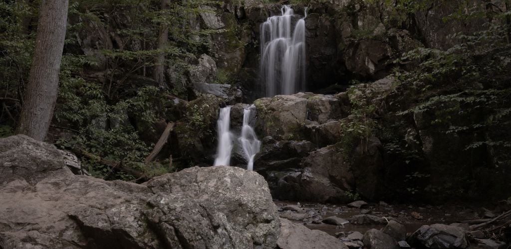
12. Lower Cascade Falls
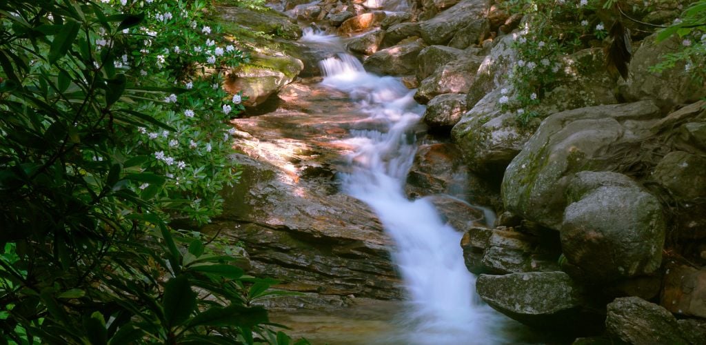
If you’re looking for waterfall hikes near Durham, then check out Lower Cascade Falls. A relatively easy and short walk that leads you to some fantastic falls at the end of the trail. At around 20 feet tall, it’s not the biggest waterfall in North Carolina by any stretch, but its beauty and tranquil surroundings are well worth the trip.
The 20-minute walk from the parking area is mostly flat and fairly straightforward but does include quite a few stairs. The water around the Falls also makes for a great swimming spot, especially during the summer months. It’s a short but serene hike that will make you glad you have a camera on your phone!
Parking can sometimes be tricky, so I recommend you head out early if possible. Weekdays are always likely to be quieter and are my recommended times to visit the Falls.
Trail Details and Information
Location: Cascades Rd, Walnut Cove, NC 27052, United States. Click here for directions to the trailhead.
Length: 0.7 miles / 1.1 km
Duration: 15-20 minutes
Type of Trail: Out and Back
Elevation Gain: 28 meters
13. Wilmington Riverwalk

A couple of hours’ drive to the east of Durham is the wonderful city of Wilmington, NC. It’s known for its historic downtown area, cultural attractions, and proximity to the Atlantic Ocean. Situated on the Cape Fear River it’s a really great city and is worth traveling out to for some of the best day hikes around Durham.
Starting in downtown Wilmington and running along the Cape Fear River is a scenic promenade that offers stunning views of the river, boats, and the historic district of the city. The pedestrian walkway has plenty of places to cut back into town for refreshments. It’s also lined with benches perfect for quick stops and people-watching.
While not directly on the riverwalk, the World War II battleship USS North Carolina is located nearby and can be easily accessed from the waterfront. It’s a popular tourist attraction and a nice piece of history that can easily be added to the walk. The Wilmington Riverwalk, though not overly challenging is one of the best hikes around Durham.

Trail Details and Information
Location: Wilmington Downtown Riverwalk, Wilmington, NC 28401, United States. Click here for directions to the trailhead.
Length: 3.5 miles / 5.6 km
Duration: 2-2.5 hours
Type of Trail: Out and Back
Elevation Gain: Predominantly flat
14. Brumley Forest Nature Preserve North

A couple of my favorite hiking trails near Durham are found at Brumley Forest Nature Reserve, just a short hop to the south of Durham. The nature reserve has a couple of great trails that take in beautiful woodlands, streams, and native North Carolina plant life.
The north route is a moderate walk over well-maintained paths, however, they can get quite muddy after heavy rain. It’s advisable to wear good walking boots or plan ahead based on the weather.
The route is well-signposted throughout and offers some tremendous wildlife-spotting opportunities. Though I didn’t see any, friends have reported seeing deer on the walk previously – keep a look out!
There’s not much of an elevation gain along the route, making it an accessible walk for most levels of fitness. Along the way, you’ll find plenty of picnic benches and places to rest weary legs should you need to.

Trail Details and Information
Location: 3055 New Hope Church Rd, Chapel Hill, NC 27514, United States. Click here for directions to the trailhead.
Length: 3.2 miles / 5.1 km
Duration: 1.5-2.5 hours
Type of Trail: Circular
Elevation Gain: 35 meters
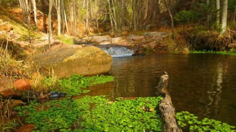
15. Buckquarter Creek Trail
There’s loads of good hiking in Durham and on most trails, you’ll find the option to take a shorter route or make your hike more challenging. Eno State Park is certainly one of the best places to go for Durham hiking so it’s been pretty prevalent on my list. The Buckquarter Creek Trail is another great example of a beautiful scenic forest and river walk.
With moderate elevation gains and a route that’s pretty much half forest and half riverside, this 1.5-mile circular route is a nice option for getting some fresh air and exercise. It could easily be combined with any number of Eno River walks to cover a greater distance.
At certain times of the year, you’re even able to walk across the Eno River as the water level is so low. It’s a great place to dip your feet in the mighty river but be cautious and follow any warning signs.
Trail Details and Information
Location: 6101 Cole Mill Rd, Durham, NC 27705, United States. Click here for directions to the trailhead.
Length: 1.5 miles / 2.4 km
Duration: 45 mins-1.5 hours
Type of Trail: Circular
Elevation Gain: 43 meters
Where to Stay in Durham for Hiking

These are a few of the best neighborhoods and areas in and around Durham, which make for great bases when hiking around the city:
Downtown Durham
Downtown Durham is a great place to stay if you like having plenty of bars and excellent restaurants on your doorstep. It’s a really lively area that’s home to a number of iconic Durham establishments such as The Blue Note Grill and Kings Sandwich Shop. Everywhere is easily walkable and it’s a safe and friendly place that also has an arcade, coffee shops, and breweries.
Here, you’ll also find the Historic Durham Bulls Athletic Park, the former home of the Durham Bulls baseball team and an iconic landmark for the city. It was used as the setting for the 80’s cult film Bull Durham starring Kevin Costner and Susan Sarandon.
Check out this great apartment. It’s ideally located close to everything Downtown and even includes a swimming pool. Click here to find out more.
Trinity Park
Trinity Park is predominantly a residential area but is situated perfectly for all Durham has to offer. A 10-minute walk from Downtown and close to the historic Warehouse District, residents and guests have a bit of everything in Trinity Park. Duke East Campus is just a few minutes’ walk away too, so there’s plenty of history and culture in this area.
The quiet, tree-lined streets and impressive houses create a real community vibe. There are also a number of churches, schools, and parks.
There are many great cottages, apartments, and homes to rent in Trinity Park but if you’re looking for a hotel, check out this great option and apartment complex by Marriott. Click here to find out more.

Southpoint
Southpoint is situated around 6 miles outside of central Durham but is another great area to stay. Not only is it so close to The Streets at Southpoint, a huge shopping mall complex and hub for restaurants and events, but it’s also positioned for some of the best hiking in Durham.
With great access to RDU International Airport, and Research Triangle Park, there are many reasons to consider staying a little further out of town.
There are some great hotel options in Southpoint, one of which is the Hilton Garden Inn which has a fitness center, indoor pool, and free parking. Click here to learn more.
Hiking in Durham: FAQs
Here are some answers to commonly asked questions about the best hikes in Durham:
The Cox Mountain Loop Trail is arguably one of the most popular hikes in Durham. Located at the beautiful Eno River State Park, it’s both a river and forest hike that’s understandably popular with visitors. There are numerous great trails to be found around the Eno River.
Weymouth Woods is a great place to go for some well-maintained and steady trails with minimal elevation gains. Here, you’ll find many short routes that can be added together to make longer hikes if you wish. Weymouth Woods is home to around 250 Long Leaf Pines, a rare tree for this area of North Carolina.
Lower Cascade Falls is a great spot to see a waterfall during a hike. The Falls are around 20 feet tall and aren’t the biggest in North Carolina, but are a spectacular sight that makes for an excellent addition to any outing. Lower Cascade Falls can be reached by a fairly straightforward 20-minute walk that includes a number of steps.
Always wear sturdy hiking shoes as the majority of the popular trails, although well-maintained, are still often rugged, muddy, and have uneven terrain. Be aware of the weather and appreciate that things can change quickly. Waterproofs and warm clothing are a necessity if climbing any serious elevation or hiking a long distance.
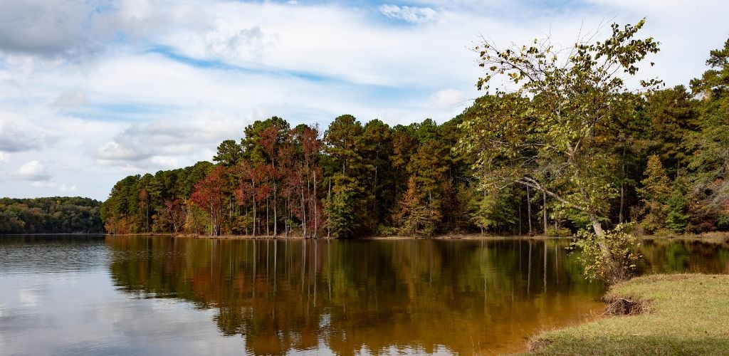
Durham hiking offers so many beautiful trails. But it’s tough to beat the beauty of Eno River State Park which ranked in my list of top things to do in Durham overall. The majestic river and stunning landscapes around it offer many trails and hikes that cater to all levels of fitness and ability, making it one of the most beautiful hikes in Durham.
All hiking presents elements of danger and Durham hiking is no exception. Weather patterns can change quickly in this part of North Carolina, and storms can blow in with minimal notice. Paths can become un-walkable and visibility can diminish fast.
The heat can also be a problem as temperatures can reach as high as 97°F in the summer months. Always plan ahead, know your route, stick to designated trails, and pack accordingly for your hike.
One of the biggest hikes in Durham is the American Tobacco Trail. What was once an old railroad corridor, built primarily for the movement of tobacco products, is now repurposed as a multi-use path and historical recreational walkway. It begins in central Durham and continues over 22 miles with many access points along the way.
The American Tobacco Trail is approximately 22.6 miles long. Starting in central Durham and leading to Apex, NC to the south. The trail takes in numerous counties along the way and has several access points for hikers and recreational visitors.
Originally built as a railroad corridor, the American Tobacco Trail was used by American Tobacco for the shipping of tobacco products.
Durham has a rich history with tobacco and many of the warehouses and factories that once played a big role in tobacco production still remain today. They have mostly been repurposed as bars, restaurants, offices, and housing.
The trail does not have set opening or closing times as it’s a public path that runs through many counties and access points. It’s advisable to walk during the day when it is safest and there’s good light to enjoy the scenery.
In Closing
Durham hiking is some of the best I’ve yet to experience. It has a mix of trails to suit every ability and a diverse landscape that presents new delights every time you head out. From waterfalls to mountain peaks, and forest paths to river walks, Durham and the surrounding areas have trails for everyone to enjoy.
I personally love having an element of history and culture during a hike and Durham has this in abundance. With a rich industrial past, and the huge Duke University in the city, the option for urban walks as well as rural hikes is a major benefit to Durham.
I really enjoyed hiking in Durham and I’m sure you’ll find plenty of great trails to keep you busy too.
The post 15 Best Hikes in Durham in 2023 (For All Levels) appeared first on Goats On The Road.


)
Recent Comments