The Canadian Rockies is the dream destination for all outdoor lovers. Whether you like hiking, mountain biking, kayaking, really any sport, the breathtaking mountains offer it all.
Because hiking is so accessible, it’s easy to see why it’s the most popular outdoor activity, no matter the fitness level.
I’m going to show you the 10 best day hikes in the Canadian Rockies. You can visit different national and provincial parks to see mountain tops, wildlife, waterfalls, and gorgeous turquoise lakes.
These hikes are just a fraction of the many I did during the eight years I’ve been living near the Canadian Rockies. And I tried my hardest to bring you the top ten hikes when you visit.
Included in this list are hikes of various difficulties so everyone can find their path.
Here’s my list of the 10 best hikes in the Canadian Rockies.
1. Galatea Lakes
- Distance: 18.7 km return
- Elevation gain: 806 m
- Difficulty: moderate
Located in Kananaskis Country, this hike features three gorgeous lakes and even a backcountry campground if you’d like to stay overnight.
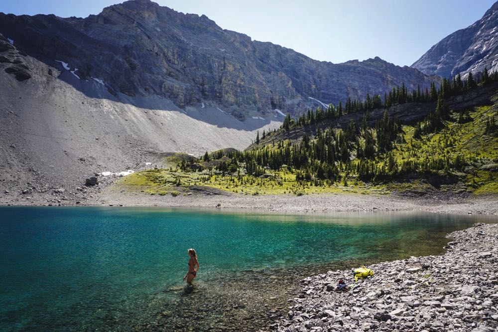
The trail leads through the forest with several creek crossings. It’s pretty flat most of the way until you reach green Lilian Lake, where the campground is. Right after the uphill switchbacks start, you get rewarded with views of mountain peaks all around you.
When you see the Lilian Lake from above, you’re close to reaching the Lower Galatea Lake. Most hikers end here, but I highly recommend continuing to the Upper Galatea Lake, where you might even have it just to yourself.
☞ See Also: 10 Best Hiking Trails in Nova Scotia, Canada
2. Grassi Lakes
- Distance: 4 km return
- Elevation gain: 220 m
- Difficulty: easy
Grassi Lakes in Canmore must be one of the most popular hikes in the Canadian Rockies. And for a good reason! The trailhead is located a short drive from Canmore, a lesser-known neighbour of Banff.
You can even walk in sandals as the trail through the forest is wide and easy. If you choose the more difficult route, you pass a waterfall and walk on some rock stairs.
The easy route is slightly going uphill until you reach Lower Grassi Lake. If you continue around, the Upper Grassi Lake is just a few minutes away.
Benches around the lake are a perfect spot to enjoy the changing colours of the lakes, depending on the angle sun rays touch the surface.
If you’re staying in Canmore, check out these 20 fun outdoor things to do in Canmore.
3. Sulphur Mountain
- Distance: 11 km return
- Elevation gain: 700 m
- Difficulty: moderate
If you visit Banff National Park, you almost certainly hear about the gondola that can take you on top of the Sulphur Mountain. But because you’re reading this guide and like hiking, I have another option for you.
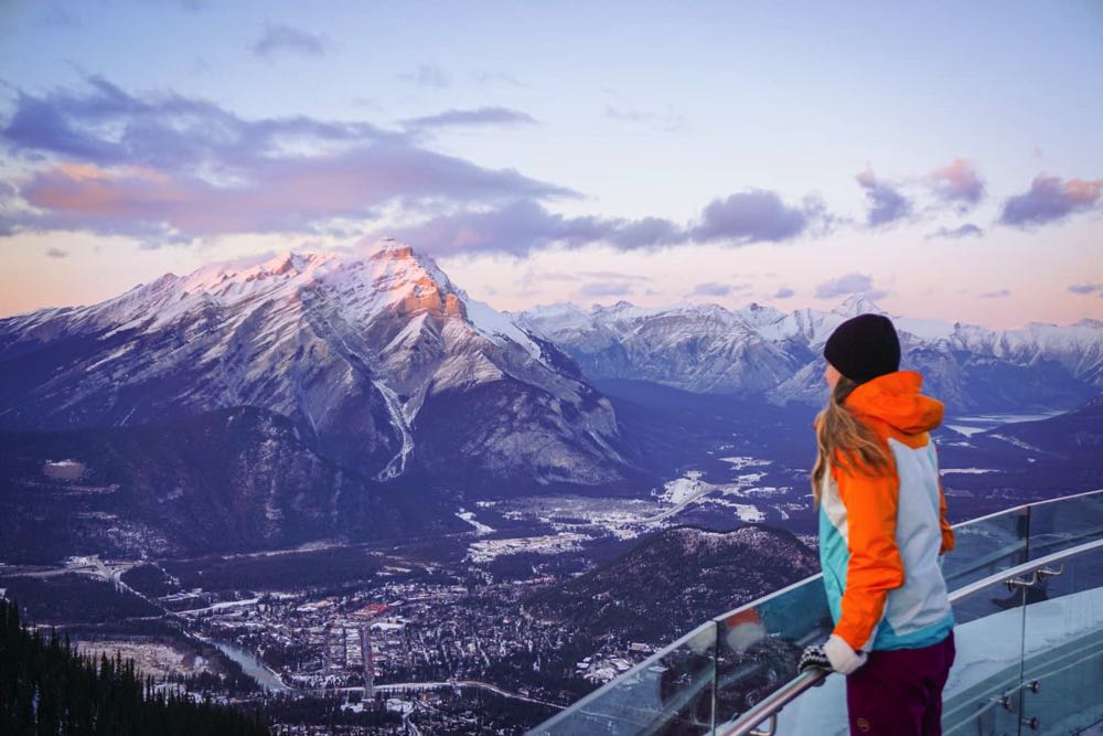
You can park at the Upper Hot Springs to hike up the mountain. The trail is slowly going uphill on many switchbacks through the forest, with occasional views of Banff town and Rundle Mountain across the valley.
After about 4.5 km, you reach the gondola’s upper terminal and continue on the boardwalk for another kilometre to Sanson’s Peak. The view of the surrounding mountain peaks and valleys is unforgettable.
The best news is, you can do Sulphur Mountain Hike year-round.
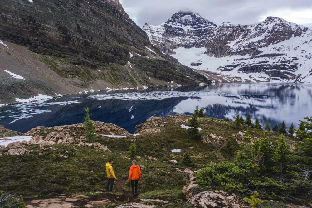
4. Healy Pass
- Distance: 19.4 km return
- Elevation gain: 650 m
- Difficulty: moderate
Healy Pass is the most colourful hike in Banff National Park if you visit in summer. This hike’s main objective isn’t a lake or reaching a mountain top, but rather hiking up the mountain pass through endless colourful meadows filled with wildflowers.
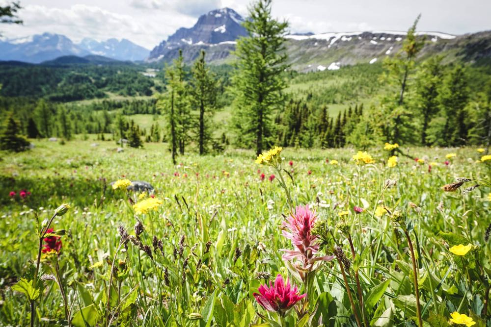
The hike starts just outside of Banff town, at Sunshine Village ski resort. The wide dirt trail follows Healy Creek, crosses several wooden bridges and offers lots of lovely views along the way.
I rated this hike moderate only because of the distance because the trail is easy. You can hardly even notice the gradual elevation gain.
After about 7 km, you leave all the trees behind and step into a colourful meadow with wildflowers as far as you can see. Reaching the Healy Pass offers another reward, a view of the alpine lake right under the mountain peak. I can’t imagine a better view at a lunch break!
5. Johnston Canyon
- Distance: 7.4 km return
- Elevation gain: 150 m
- Difficulty: easy
If you like waterfalls and canyons, visiting Johnston Canyon is a real treat for the eye. It’s located along the Bow Valley Parkway in Banff National Park, and it’s an ideal stop to stretch your legs when you’re driving from Banff to Lake Louise/Moraine Lake.
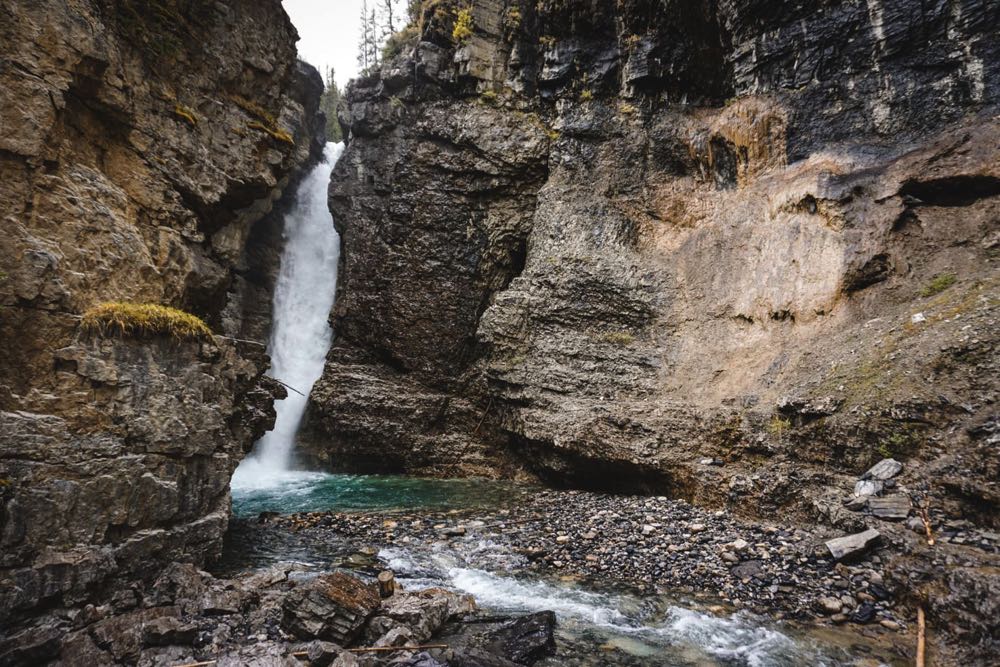
Johnston Canyon is a very popular hike with a big parking lot, washrooms, restaurant and rustic cabins.
The first kilometre is a paved path with almost no elevation at all. You hike in the forest in the canyon surrounded by bustling waters and several small waterfalls.
The first one is Lower Falls, with a stunning turquoise pool underneath. The falls are right at your fingertips if you cross the bridge and continue through a short rock tunnel. I recommend visiting early in the day to avoid lines to the tunnel.
Farther up another 2.7 km, the trail is continuing slightly uphill to Upper Falls. You should see fewer crowds at Upper Falls, but you can continue to Ink Pots if you’d like to leave behind almost all visitors.
It’s about a 6 km trail to five blue-green pools, constantly bubbling cold mineral springs. Whichever option you choose, this hike is not to be missed if you visit Banff National Park.
6. Floe Lake
- Distance: 22.2 km
- Elevation gain: 1,000 m
- Difficulty: difficult
Floe Lake is hardly on anyone’s radar, maybe because it’s in Kootenay National Park, a less visited place than nearby neighbour Banff.
Even though Floe Lake is a day hike, there’s a backcountry campground if you’d like to stay overnight. If you like hiking with no one around to enjoy the tranquillity, Floe Lake is a great place to start.
The trailhead is located along the Banff-Windermere Highway in Kootenay National Park. You start by crossing the Kootenay River with its mesmerizing turquoise colour.
After a short walk through the bushes, the trail continues gradually uphill with several switchbacks. It’s flat most of the way and steepens on the switchbacks only.
Eight kilometers into the hike, the trail steepens significantly. The switchbacks seem endless, but when you expect them to last forever, that’s exactly when it flattens. You see the massive rock wall before you can see Floe Lake right underneath.
It’s a very peaceful place with a rocky shore where you can sit for hours. Autumn brings out nice tree colours, and summer offers the heat and option for a cold dip.
7. Iceline Trail
- Distance: 18.3 km loop
- Elevation gain: 793 m
- Difficulty: difficult
Iceline Trail is the most scenic and diverse hike I’ve tried in the Canadian Rockies. You see massive waterfalls, countless glaciers, emerald lakes, and plenty of wildlife.

The trailhead starts at Takakkaw Falls in Yoho National Park, the 2nd largest falls in Canada. You see the waterfalls right at the beginning, and an even bigger surprise is just ahead of you.
When you pass the Whiskey Jack Hostel, the trail goes steeply uphill through switchbacks in the trees. You climb above the treeline and gain about 500 meters. This is the hardest part of the hike. From now on, prepare to be in awe.
The Takakkaw Falls appear right in front of you from a different perspective, and as a bonus, you also get to see the massive glacier above feeding the falls.
The trail continues on a rocky path with the most spectacular views – glaciers on your left and Takakkaw Falls far right.
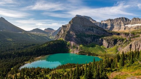
A total change of scenery happens as you pass the glaciers and step into a lush green forest with several emerald lakes.
After about 4 km on the Celeste Lake Trail, you reach Little Yoho Valley, where the trail flattens until the end. But it’s far from getting dull as there are several waterfalls before you finish the loop and reach Takakkaw Falls.
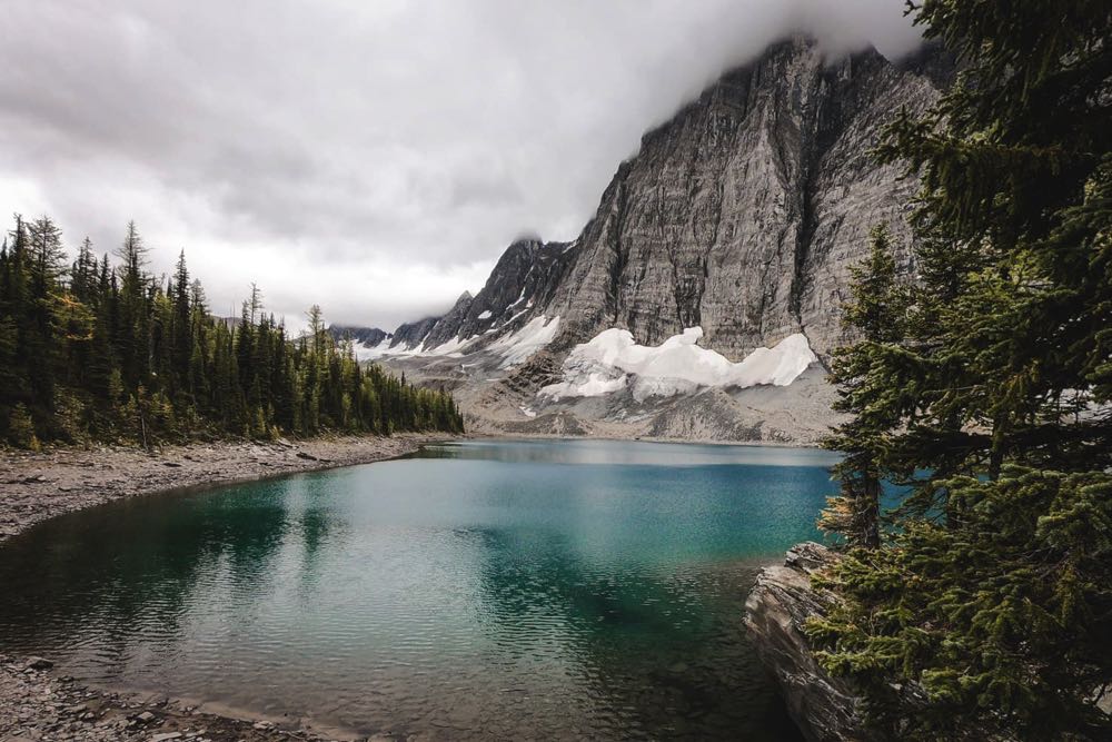
8. Lake O’Hara
- Distance: 3 – 9 km
- Elevation gain: 0 – 300 m
- Difficulty: easy to difficult
Lake O’Hara area in Yoho National Park is the most pristine and beautiful place I’ve seen in the Canadian Rockies. There’s no overcrowding because only a limited number of people can visit each year.
The road to Lake O’Hara is closed to all traffic, and you can only get in by a shuttle bus (reservations open in April each year, and you have to be quick to secure a spot, you can book online here).
There are plenty of hikes you can do if you choose to camp overnight. For day-trippers, I highly recommend the Opabin Plateau. It’s almost 6 km long with only 250 m elevation gain.
The highlight is hiking to the cliff with a bird’s eye view of Mary Lake and Lake O’Hara next to each other and towering mountain peaks all around.
If you’re a strong hiker on a day trip to Lake O’Hara, make sure to visit Lake McArthur as well. The 8 km trail through McArthur Pass leads to a one-of-a-kind deep blue lake, quite an unusual colour for the Canadian Rockies.
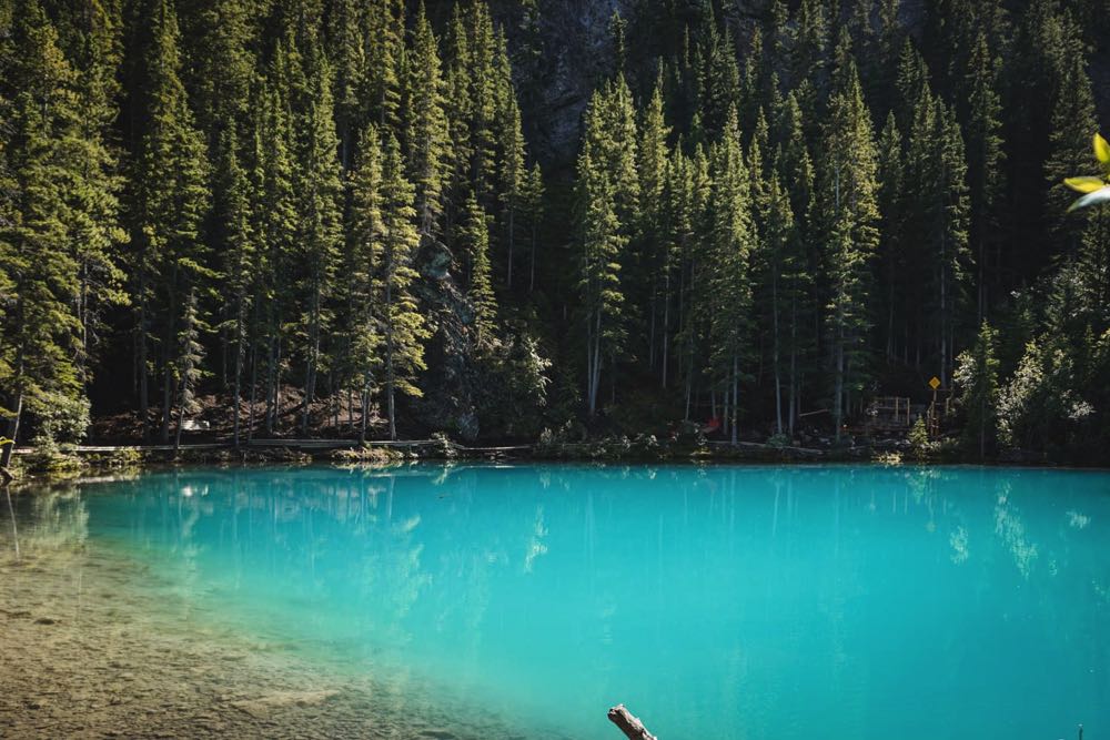
9. Valley of the Five Lakes
- Distance: 5.5 km loop
- Elevation gain: 100 m
- Difficulty: easy
Valley of the Five Lakes is a family-friendly hike accessible for all levels.
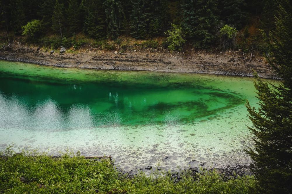
There are no steep uphills, rocks or sketchy sections, just a nice dirt trail around five astounding emerald lakes and maybe a moose hiding in the trees. It’s also a great hike when it’s raining; the green colours are just as pretty.
The trailhead is located just 10 km south of Jasper town in Jasper National Park. You start hiking through a small forest and into a lovely open meadow filled with wildflowers during summer. After about a kilometre, you reach the first and biggest lake.
But it’s the third lake that is stealing the show here. The shore has a different hue of green than the middle and changes colour based on the sunrays. It’s the most spectacular sight to experience the changing colours firsthand.
The famous red chairs are at the far end of the lake, which are usually placed at the most beautiful viewpoints in the national parks.
The following two lakes also offer benches to rest or have a nice picnic by the lake. If you visit in the morning before the crowds arrive, you have a better chance of wildlife viewing.
10. Wilcox Pass
- Distance: 8 km return
- Elevation gain: 425 m
- Difficulty: moderate
You stumble upon countless breathtaking viewpoints, waterfalls, lakes, and hikes when travelling from Banff to Jasper National Park on the Icefields Parkway. Wilcox Pass is just after the Banff-Jasper border located in Jasper National Park.
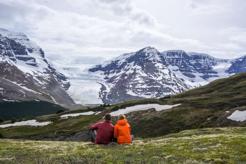
What I like the most about Wilcox Pass is the unique alpine environment where you can sit on a meadow with only bighorn sheep around and enjoy the view of the Athabasca Glacier across the valley.
The trail doesn’t finish at the same spot where it starts, and you would need to arrange a shuttle with friends. But there’s another way.
You can hike 4 km in and return the same way. You still get to see the most fantastic glacier view and sit in red chairs while watching the bighorn sheep. As a bonus, there’s a campground right at the trailhead.
5 tips for hiking in the Canadian Rockies
- Always carry a bear spray within arm’s reach (not in a backpack) and learn how to use it. In the Canadian Rockies, you’re in bear country. Make noise while hiking, so you don’t surprise any bears. Parks Canada has a great resource page for learning.
- Carry a water bottle with a filter, so you don’t need to carry a lot of water if you’re passing a creek, river, waterfall, or lake (I use a Lifestraw bottle). As you can see from this guide, there’s plenty of opportunities to fill up.
- Check the trail report before heading out. Some trails might be temporarily closed due to bear sightings or avalanche danger. Parks Canada is the most reliable source for hiking in national parks and Alberta Parks for hiking in provincial parks.
- Camping is very popular and affordable, and every area described in this guide has campgrounds nearby. You can stay in a tent, or an RV, trailer or campervan, which is the most popular option due to occasional wildlife sightings in campgrounds.
- There are no fees to enter any of these trailheads, but you need to purchase a daily Park Pass or yearly Discovery Pass for visiting any national park. For hiking in Kananaskis, you are required to buy a Kananaskis Conservation Pass.
Final Thoughts
The post 10 Best Hikes in The Canadian Rockies appeared first on Goats On The Road.
![]()


Recent Comments